Estuaries and coastal zones serve many different functions such as economic activities, recreation, nature and flood protection. An integrated approach needs to be taken to their management, but such an approach is not (yet) automatically adopted in practice. A range of diverse and sometimes uncoordinated initiatives are more likely to be followed.
The primary task of a decision-maker in the field of natural resources allocation is to solve the problem by finding a spatial distribution of available resources, acceptable to all parties involved.
Important here is the difference between problem solving and decision-making, which can be understood as follows:
- Problem solving is a process in which we perceive and resolve a gap between a present situation and a desired goal, with the path to the goal blocked by known or unknown obstacles.
- In contrast, decision-making is a selection process where on the basis of sound problem analysis one out of two or more alternative solutions is chosen to reach a desired goal.
In such a dynamic social environment, driven by a host of competing players and interests, integrated policy-making for estuaries and coasts is a complex and generally time-consuming business. There is often a great deal of information available, but it tends to be fragmented, incomplete, scattered between authorities and by no means always traceable or organised. Even once it has been assembled, stakeholders must communicate the information available so that its use will not provoke resistance or conflict. This can be achieved by involving stakeholders in the policy making process at an early stage. An interactive open planning process meets these needs if it actively involves stakeholders in decision-making right from the initial investigation of the problem.
Planning processes are normally triggered by a need for change or prompted by a specific problem as it develops. In the course of the planning process, new situations constantly arise. The various stages in a (interactive) planning process can be supported by a variety of computer tools
For more details see the section Tools under the chapter Practice in this Planning module. |
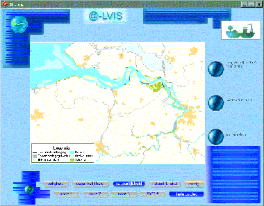
Figure 1-2 @-LVIS is a tool purposely designed for information exchange to the stakeholders in the project: Sustainable development of the Scheldt Estuary (Belgium / The Netherlands) |